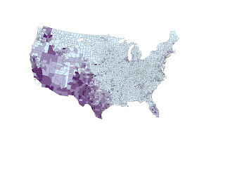

This map of "Some Other Race Population" shows that the density of population percentage of "other races" is strong in the Southwest. Because these states and counties border Mexico and other Gulf islands, the minority population is higher. Immigrants and the generations that follow them stay in the Southwest region.
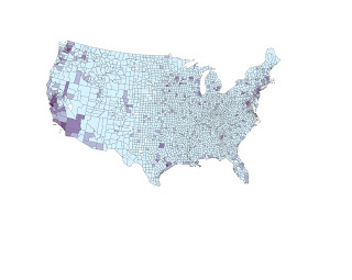
Asian Population Map:


The Asian Population map shows the density of Asians in both the west coast and east coast of the country. The population is higher here because of the bordering oceans and the immigrants that came to America from Japan, Korea and China. The east coast has a higher population of Asian people because of the higher population in cities. Metropolis areas like New York, Boston, Philadelphia, etc... are melting pot cities with many immigrants and minorities. This explains the higher population of Asians in these cities than in other parts of the U.S.
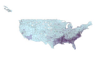
Black Population Map:


The Black Population is highest in the South. This can be explained by American history and the fact that slavery took place in the South, and since then, many African Americans have populated the South more than other areas in the U.S.
These maps visually display the trends in population that many people take for granted. Depending on where you are in the U.S., your worldview concerning other races changes drastically. This map shows that in big cities like New York and L.A., population is diverse, as well as many coastal areas. Places like the South and the southwest have diversity, but with fewer races in the mix. Our country is one that has attracted immigrants for centuries and now the racial make-up of the U.S. reflects that.
The GIS capabilities that allow for visually displaying information like this is so useful. Throughout this quarter, we have used GIS in many different ways and explored it's capabilities. It has been a challenge at times to learn such a complicated program, but the more I use it, the more things I discover it can do, and the more comfortable I get with it. My impression of GIS is that it is something I wish I could explore more, and something that I am continually impressed by. The unlimited uses for GIS are creating more and more ways for geographers to examine our world in an extraordinary way.

No comments:
Post a Comment